The property currently includes:
26 divided ‘condo’ lots/tax parcels, a separate 3.27 acre parcel along Glidden, and 2 forty-acre parcels of vacant land located in the Town Sevastopol in Door County.
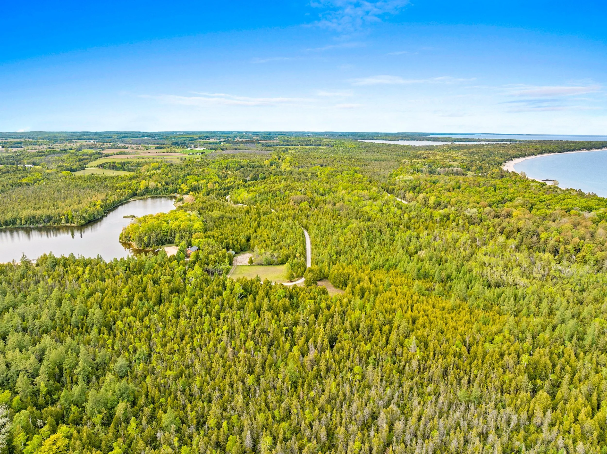
The wooded condo lots are comprised of approximately 74 acres of land along Lake of the Woods Rd. The condo lots contain varying amounts of wetlands and some have frontage on a private spring-fed lake. One of the waterfront lots has been improved and contains a 2500 SF house and a 720 SF detached garage.
The 2 forty-acre parcels contain wooded wetlands and lake frontage.
Parcel Details…
-

Development Potential
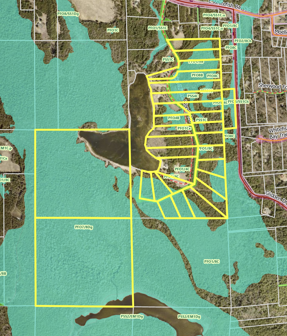
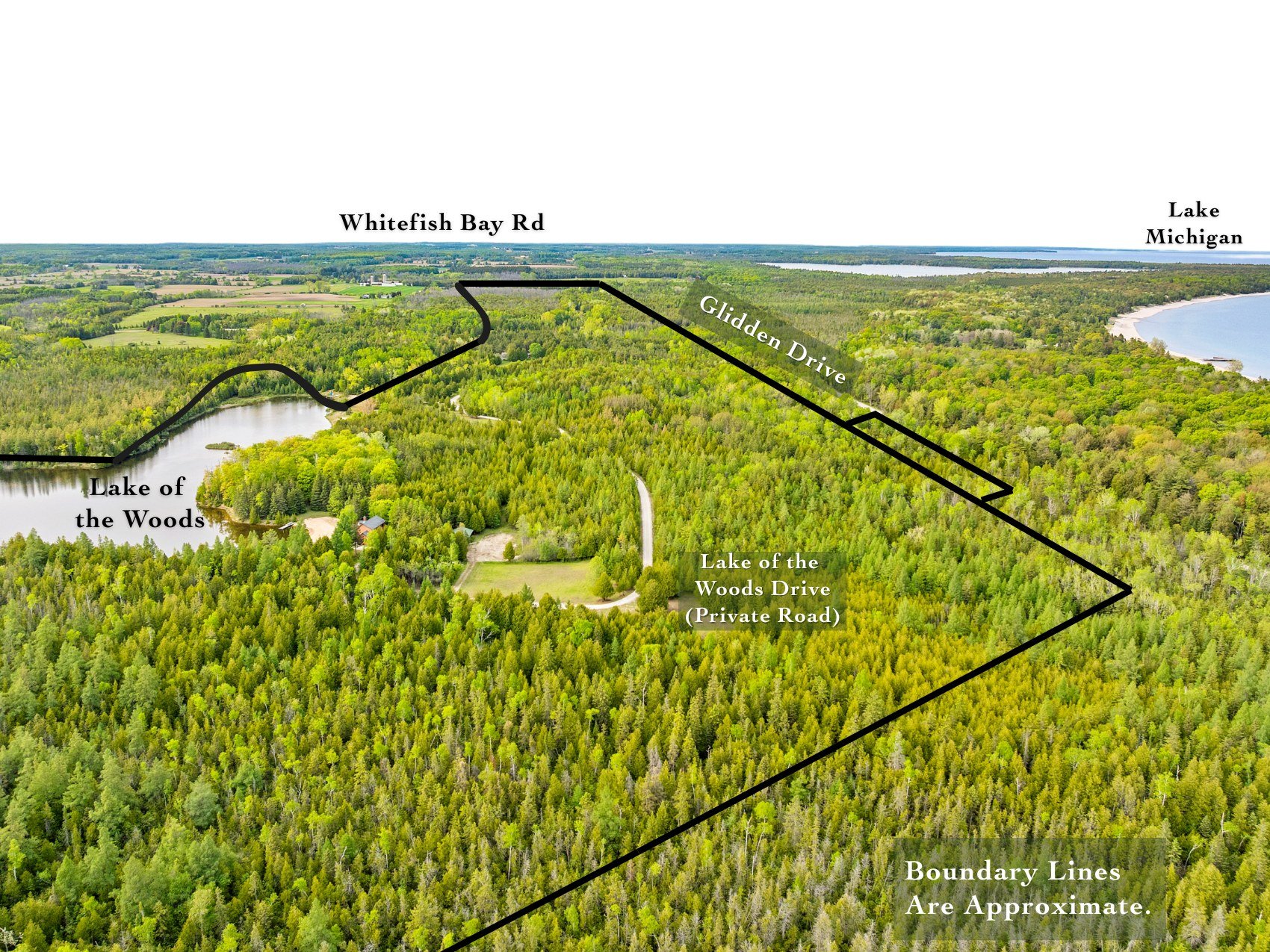
The path to develop Lake of The Woods is already in place as it is currently divided into 26 separate tax parcels ranging from 1.5 to 3+ acres. If you are considering developing, our recommendation is to consider pairing together multiple lots to create bigger, more private, parcels - first understanding where the buildable (uplands) and not-buildable (wetlands areas) are.
All parcels are denoted by the yellow border in the map above.
Per Door County Zoning Administration:
The underlying zoning district is Small Estate (SE). This is a stationary layer that does not change unless a petition for a map amendment is approved. Principal structures shall be located a minimum of 20' from side lot lines and 50' from rear lot lines.
The lake is also hydrologically connected to Lake Michigan by the surrounding wetlands so it is subject to the Door County Shoreland Zoning Ordinance (DCSZO).’
-
Wetlands and Uplands
The additional 80 acres are also currently designated as wetlands. Approved usage on Door County wetlands include hunting & hiking. A proposed concept would be to keep these 80 acres as a private nature reserve- available as a common area that all future residents within Lake of The Woods Estates would have mutual access to as these parcels border an additional 800+ acres of state and conservancy land, including Cave Point–Clay Banks SNA and Shivering Sands Preserve.
Suggested wetlands are denoted by the blue layer in the map above.
Per Door County Zoning Administration:
‘The wetland layer is an approximate extent. The actual wetland boundary may be determined by a wetland delineator. No fill may be placed in a wetland, including gravel to install a driveway, woodchips or the piling of brush. All structures shall be located a minimum of 35' from any wetland boundary.‘To be able to build a house on any lot, access shall be able to be obtained through an upland area. (Access may not be taken through a wetland, unless a petition for a map amendment is approved to rezone a wetland to the upland zoning district). Lots may be combined, as long as they are at least 1.5 acres in area, which would meet the Small Estate zoning district requirement.”
-

The Glidden Parcel
A 3.27 acre lot that zoned Single Family - 20,000 on Glidden Road is an included bonus parcel.
Purple Layer = Small Estate (SE)
Blue Layer = Wetlands
Yellow Layer = Single Family 20,000
Wetland Delineations
The current Door County GIS maps have proposed much of this area as Wetlands. Future investors will want to complete a wetland delineation with the DNR to confirm where the wetlands actually exist and how much of the area it actually covers.
